Its been said so many times and written wrong so many times; for various reasons, either by the proponents of Francis Drake landing at the Pt. Reyes National Seashore and Drakes Bay or by people who’ve never researched the topic in the slightest and just parrot what they’ve been told.
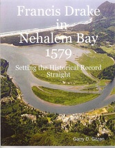
Quite frankly, white cliffs are never mentioned in the Francis Fletcher journal “The World Encompassed”. What it does say is: “cliffs and white banks”. Take it to mean what you want but, Neahkahnie Mountain’s cliffs fall directly into the sea from its height of 1631 feet. This is the highest point on the Pacific Ocean from British Columbia to the So. California border. Extending south from Neahkahnie Mountain is 8 miles of sand dunes; pristine white banks. Neahkahnie Mountain is pictured on the cover of my book where you can see its cliffs and running south from Neahkahnie are the pristine white banks of the Nehalem Bay state park even today.
There is much more to the description of the landing site than just the cliffs and white banks. The flora of Oregon is very much like Plymouth, England whereas no California coastal flora is similar to Plymouth. Additionally, the Spanish Captain Sebastian Cermeno who was shipwrecked in 1595 at Pt Reyes/Drakes Bay described the coast as Castilian, i.e. Spain. Only in someone’s wildest dreams would Francis Drake have thought Pt Reyes/Drakes Bay or any of the other pretending bays, reminded him of England in the slightest..
And then there is the Hondius Broadside Map (1589) with a rendition of Nehalem Bay in the upper left hand corner. All of the other pretending sites either do not match, are directionally mismatched North, East, South or West; or they refuse to recognize the map all together as one of the primary documentary icons of Drakes voyage. My book lists 9 areas of the map which correspond directly with Nehalem bay to name just a few.
Cheers
 RSS Feed